Coastal County Snapshots

Generate a report for any coastal county that shows complex data in brief stories, complete with charts and graphs. Local officials can use the snapshots to assess their county’s resilience to flooding. The snapshots can also serve as an educational tool when working with governing bodies and citizen groups.
Snapshots are available for four topics:
Marine Economy - Businesses that are dependent on marine and Great Lakes resources are particularly vulnerable to coastal hazards.
Total Coastal Economy - Understanding the businesses at risk from a changing climate is important. This data covers all economic activity occurring in coastal shoreline counties: jobs in banks, grocery stores, local government, and everything in between.
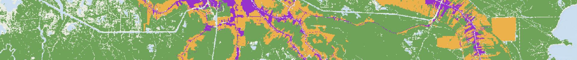
Sea Level Rise - Visualizing communities' exposure to sea level rise can help you integrate this information into community planning strategies. In many communities, rising sea levels are already increasing the impacts of high tide flooding and storm surge events.
Special Flood Hazard - To create the beginnings of a vulnerability assessment, this snapshot combines local vulnerability data with maps that depict the 100-year floodplain.