Tool
USGS Current Water Data for the Nation
Description
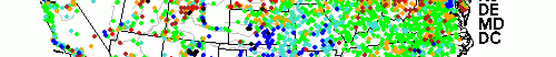
This map depicts streamflow conditions as a percentile, which is computed from the period of record for the current day of the year.
Details
Hazards
This map depicts streamflow conditions as a percentile, which is computed from the period of record for the current day of the year.
![]()